


Tour de Ré complet

francisdean
User

Length
71 km

Max alt
17 m

Uphill gradient
294 m
Km-Effort
75 km

Min alt
-4 m

Downhill gradient
294 m
Boucle
Yes
Creation date :
2019-01-15 15:10:54.931
Updated on :
2019-06-01 15:09:07.12
2h44
Difficulty : Medium

FREE GPS app for hiking
 SityTrail
IGN / Geographical institutes
SityTrail Plus
The world is yours!
About
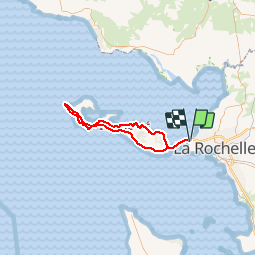
Trail Cycle of 71 km to be discovered at New Aquitaine, Charente-Maritime, La Rochelle. This trail is proposed by francisdean.
Positioning
Country:
France
Region :
New Aquitaine
Department/Province :
Charente-Maritime
Municipality :
La Rochelle
Location:
Unknown
Start:(Dec)
Start:(UTM)
637485 ; 5114791 (30T) N.
Comments